The Spatial Conditions of Japanese Internment

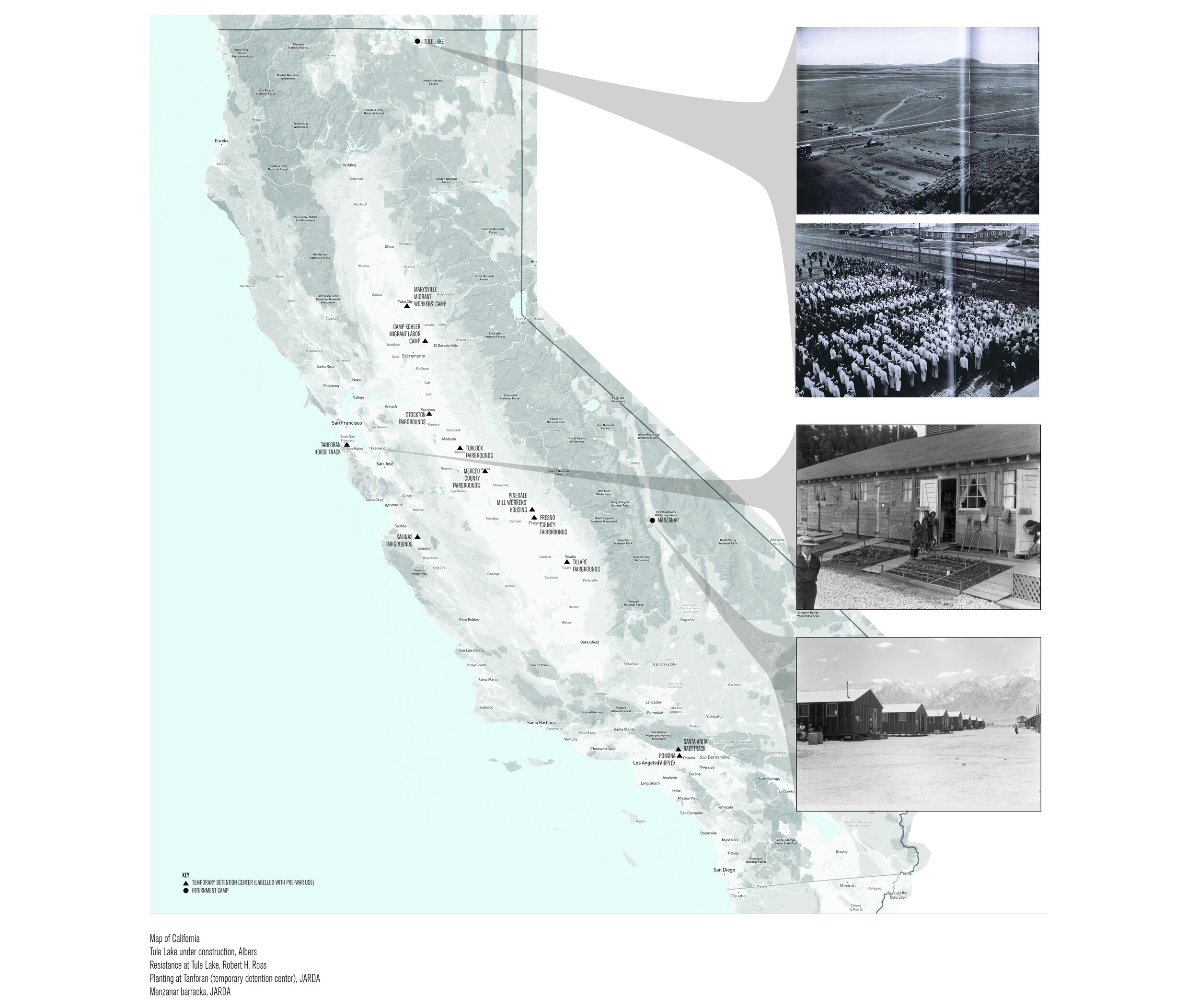
The landscape of Japanese internment, 1942-1948.
During World War II, shortly following Japan’s attack on Pearl Harbor, President Roosevelt issued Executive Order No. 9066, which ordered the U.S. Western Defense Command to locate and incarcerate West Coast Japanese Americans without due process. Approximately 120,000 American citizens and permanent residents of Japanese ancestry were evacuated from their homes and confined in government-sanctioned camps.
Scholars of the internment camp history often do not explore the racialized landscapes that these narratives occur within. The history of Japanese internment often is described as occurring within desolate, rural places with no existing residents. The growth of the American West has been marked by the federal government’s visions of the West “as a tabula rasa conducive to implementing state visions.” Compared to the eastern half of the country, “the West posed fewer constraints than did other regions to large-scale initiatives such as irrigation projects, multipurpose hydroelectric dams, the testing of atomic weapons, and the incarceration of Japanese Americans.” Internees were expected to be a source of labor, such as raising crops and maintaining irrigation systems.
Shelley Cannady, “Tule Lake Today: Internment and Its Legacies,” Boom: A Journal of California 3, no. 1 (2013): 20.
Greg Robinson, After Camp (Berkeley: University of California Press, 2012), 1.
Robert Wilson, “Landscapes of Promise and Betrayal: Reclamation, Homesteading, and Japanese American Incarceration,” Annals of the Association of American Geographers 101, no. 2 (February 2011), 428.
The sudden clearing of the West Coast of Japanese Americans meant that thousands need to be moved into temporary “assembly centers” while internment camps were being constructed. Management of these centers was administered by the WCCA, and staffed by surplus employees from the Works Progress Administration (WPA). In total, fifteen assembly centers were created, twelve located in California. In order to reduce the need for constructing barracks, livestock pavilions, fairgrounds, and animal stables were most often used.
Across the ten internment camps, barracks were on average “twenty by 120 feet, divided into four or six rooms,” with “one family assigned to one room, twenty by twenty feet.” Interior conditions were bare and minimal, with “a pot bellied stove, a single electric light hanging from the ceiling, an Army cot for each person and a blanket for the bed.”
Manzanar
Manzanar, located in the Owens Valley of central California, was 225 miles northeast of Los Angeles, and held Japanese Americans from southern California, Stockton, and even Bainbridge Island, Washington. Many families who had moved from warmer areas of southern California were ill-equipped for the high winds and 4000 feet altitude at Manzanar. The War Department, which had been given control over the camps, “began to issue military surplus from the First World War,” and later “sewing machines were shipped in, and one barrack was turned into a clothing factory” to alter the clothing from its average white male standard size to fit the relatively smaller frames of Japanese Americans.
After internees were permitted to leave Manzanar, its 500 residential barracks were sold to private entities and relocated along the Owens Valley. Andrew Freeman’s photography project, “(Manzanar) Architecture Double,” demonstrates how “the new owners of these barracks and their doubles coax new functions, and new meanings, from the residue of the wartime experience.” These converted barracks now hold new functions as motels, Cub Scout headquarters, churches, Indian Reservation offices, and hunting cabins. With the new functions came new signage and exterior cladding materials, but the form of the barracks remained largely the same.
Hunting cabin in Olancha, California. Image Courtesy of Andrew Freeman.
Lone Pine Budget Inn, Lone Pine, California. Image Courtesy of Andrew Freeman.
These minimal wooden barracks have been absorbed into the rugged California wilderness aesthetic with relative ease. What once was a site of imprisonment for multiple families is now a place of nostalgic leisure, reframed with a functional bungalow lifestyle.
Tule Lake
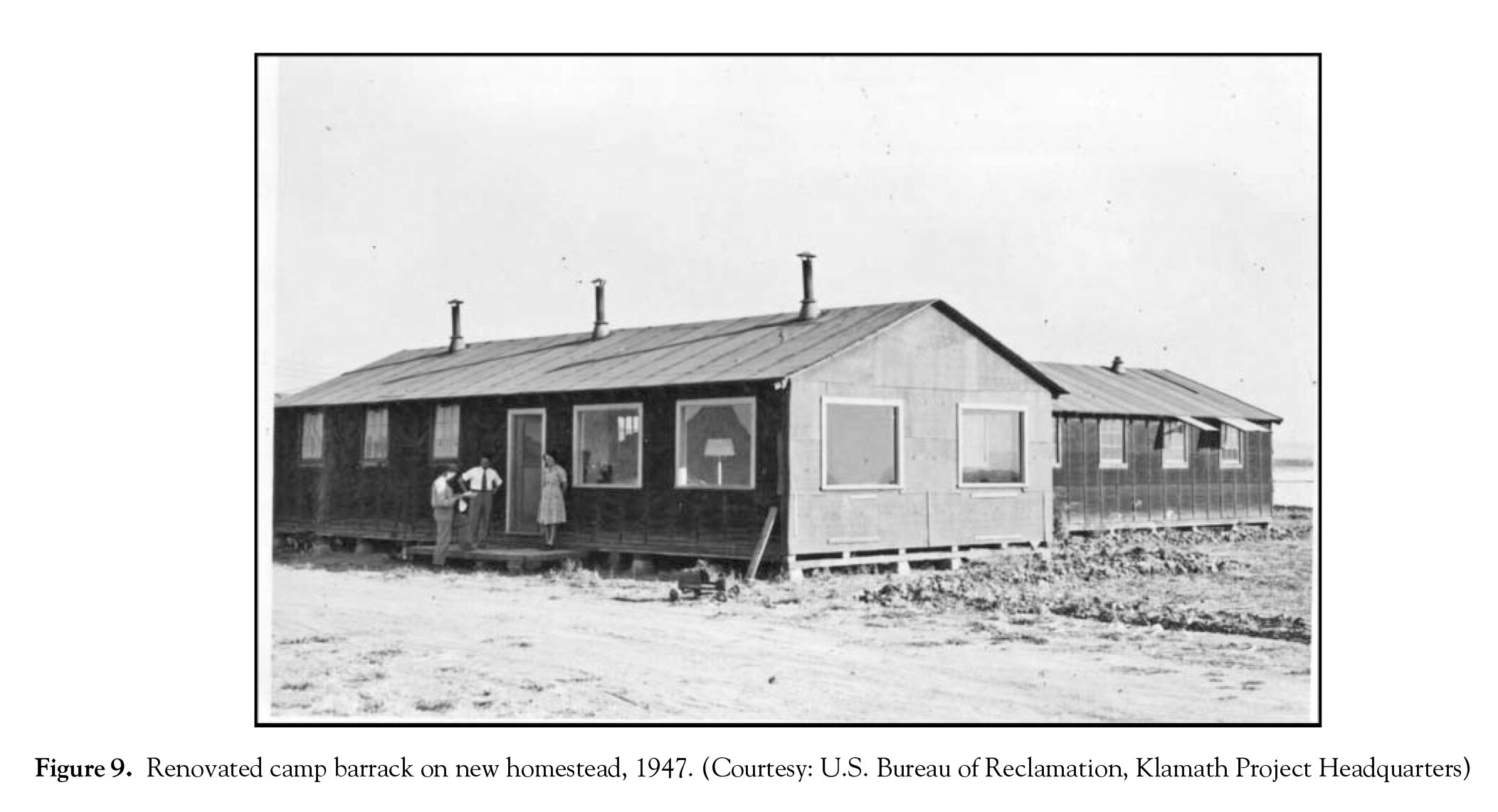
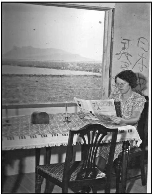
After the war ended, the land that once held Tule Lake War Relocation Center was turned over to become federally dispensed agricultural land. Over 2000 veterans applied to a lottery to win land in the Bureau of Reclamation Klamath Project. Despite the fact that many Japanese Americans were farmers before the war and some applied, none received any of this homestead land. The land was divided such that each quarter mile square portion of land held one barrack.
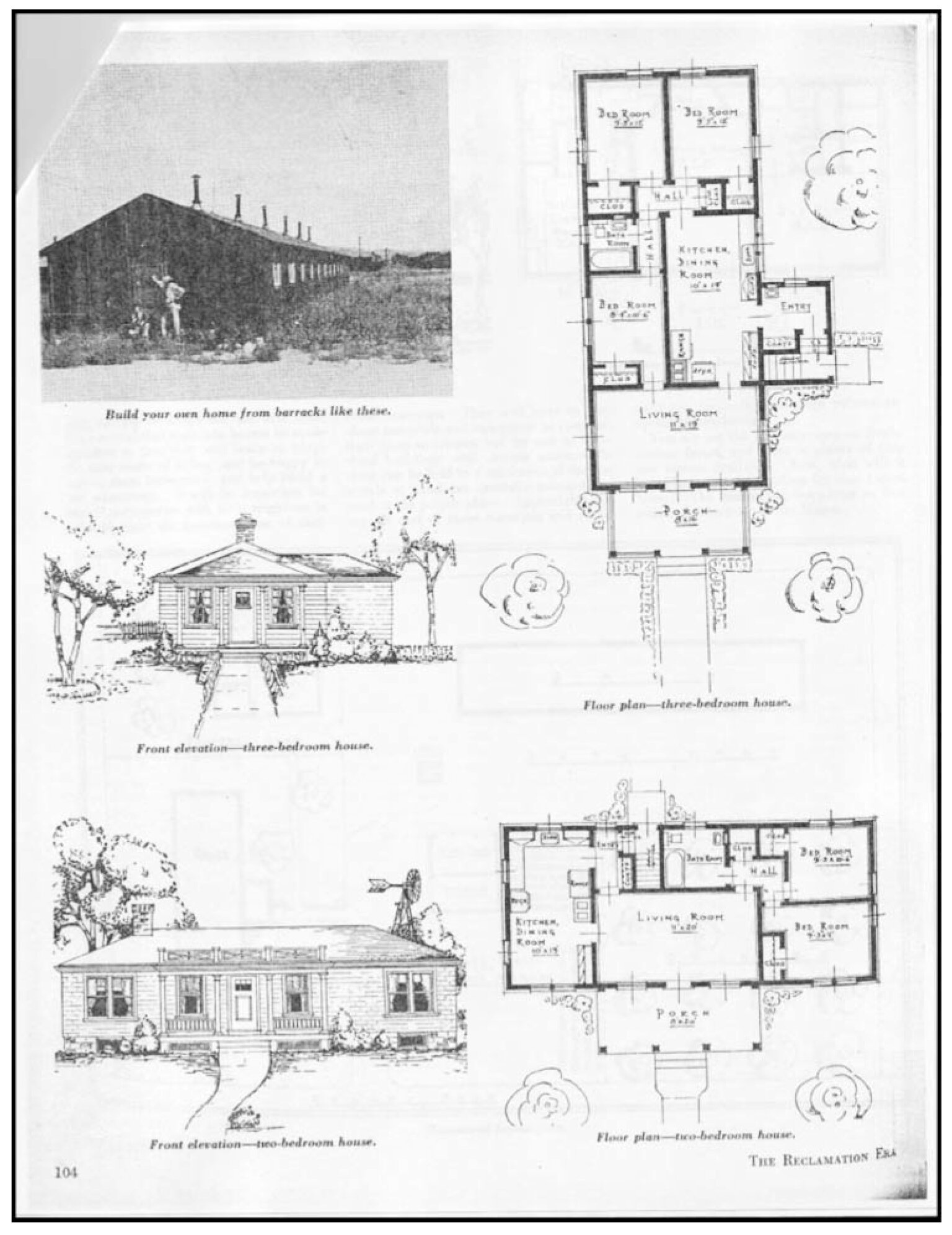
Carl Thye, a Bureau of Reclamation architect-engineer, created plans suggesting how one might convert their barrack into a single-family home, as well as a set of instructions how to lift and relocate the barracks to its new location. These designs were so popular that the neighbors with non-barrack homes requested the plans so their homes could be renovated in similar styles. Thye’s architectural prowess was celebrated by the press for his work; he is quoted saying, “the barracks, being 20 feet wide and 120 feet long provide some thing of a design problem, but they are well constructed, and when the black tarpaper is removed, can be made very attractive.” Homesteading began with acquiring land from Native Americans to create federal land settlements, using Japanese Americans as agricultural labor to till the land, and finally, “with their departure, federal agencies and local residents obliterated much of this non-white space and returned to constructing a white agrarian landscape as they had before the war.”


